Fort Beausejour 1751 – June 1755
Fort Cumberland after June 1755
Before 1784, this area — now known as Westmorland County,
New Brunswick — was part of Sunbury County in Nova Scotia.
Historic events that occurred here in the 1750s, 1760s, and 1770s
took place in what was then Nova Scotia. Plaques and monuments
commemorating events that happened here before 1784 are included
in this collection of Nova Scotia historic markers. These include the
capture of Fort Beausejour in 1755, and the Eddy Rebellion of 1776.
From 1759 to 1784, Nova Scotia and Massachusetts shared a common boundary.
Nova Scotia’s western boundary was the eastern boundary of Massachusetts.
In 1784, the Nova Scotia side of this boundary became New Brunswick.
In 1820, the Massachusetts side of this boundary became Maine.
On 22 May 1755 a fleet of three warships and thirty-three transports
carrying 2100 soldiers sailed from Boston, Massachusetts, landing at
Fort Lawrence on 3 June 1755. The following day the British forces
attacked Fort Beausejour and on 16 June 1755 the French forces
evacuated to Fort Gaspereaux, arriving on 24 June 1755 and onward
to Fortress Louisbourg where they were re-garrisoned on 6 July 1755.
This battle proved to be one of the key victories in the
Seven Years War
which saw Britain gain control of all of New France and Acadia.
http://en.wikipedia.org/wiki/Isthmus_of_Chignecto
Aulac Westmorland County, New Brunswick
(formerly Sunbury County, Nova Scotia)
GPS location: 45°51’49″N 64°17’33″W
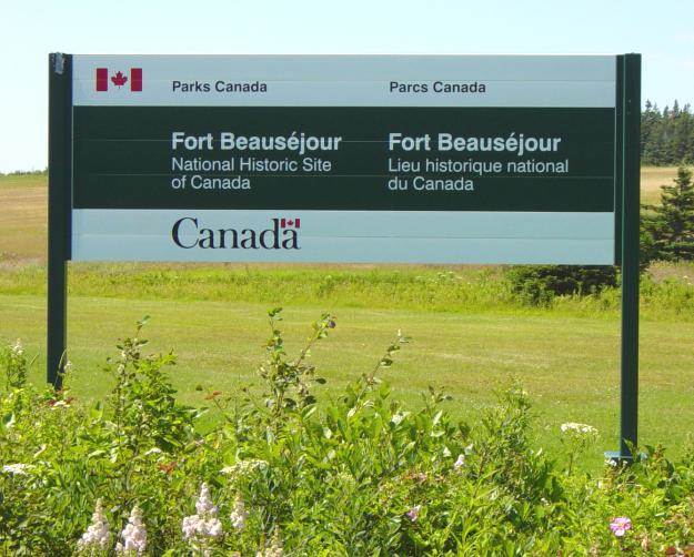
Photographed on 8 August 2005
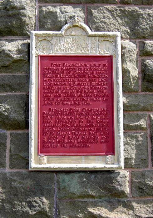
Photographed on 24 June 2005
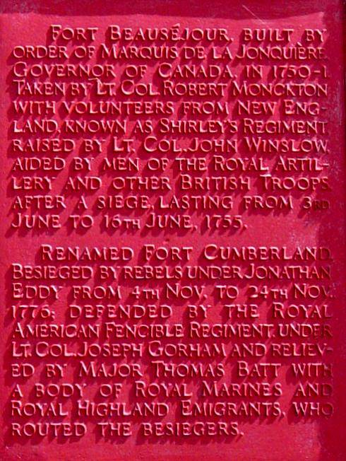
Photographed on 24 June 2005
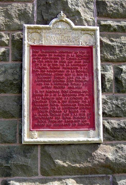
Photographed on 24 June 2005
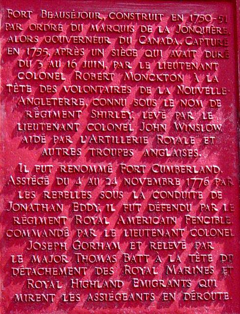
Photographed on 24 June 2005
Photograph of the Fort Beausejour Museum showing the location of these two plaques.
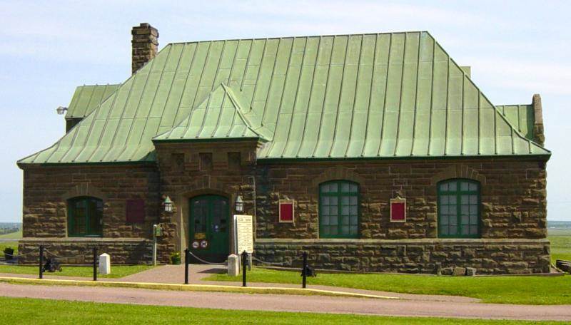
Photographed on 24 June 2005
This photograph (above) shows two small cannons (circled below)
on either side of the main entrance to the Fort Beausejour Museum.
Just one week after this photograph was taken, these two cannons
were stolen, during two separate nights, June 30th and July 2nd, 2005.


Photographed on 24 June 2005
Fort Beausejour Fort Cumberland
Two Fort Cumberlands
There are two forts named Cumberland that had military
significance during the Seven Years War 1754-1763:
One is located in present-day Cumberland, Maryland.
The other is near present-day Amherst, Nova Scotia.
The Taking of Fort Beausejour, 1755
http://www.blupete.com/Hist/NovaScotiaBk1/Part6/
Scenes/FortBeauAttackPlan.htm
Fort Beausejour: Beyond The Isthmus – Disputed Territory
Part Six, 1755 – Chapter Two, by Peter Landry
http://www.blupete.com/Hist/NovaScotiaBk1/Part6/Ch02.htm
Aerial Photograph of Fort Beausejour Government of New Brunswick
http://www.gnb.ca/cnb/televox/photo/beausejour-large.jpg
Fort Beausejour: The Attack and The Aftermath
Part Six, 1755 – Chapter Three, by Peter Landry
http://www.blupete.com/Hist/NovaScotiaBk1/Part6/Ch03.htm
Fort Beausejour by Quebec History Encyclopedia
http://www2.marianopolis.edu/quebechistory/encyclopedia/FortBeausejour.htm
Isthmus of Chignecto: Communications and Transport in the 1750s
Excerpted from the Parrsboro Citizen, 9 December 2000
http://alts.net/ns1625/nshist02.html
Fort Cumberland: The Eddy Rebellion, November 1776
Part Six, 1755 – Chapter Twelve, by Peter Landry
http://www.blupete.com/Hist/NovaScotiaBk2/Part2/Ch12.htm
Seven Years War
Timeline of the Seven Years War 1754-1763
The period 2004-2013 is the 250th anniversary of the
Seven Years War, a.k.a. the French and Indian War.
Includes important events in Nova Scotia.
https://ns1763.ca/remem/7yw-timeline-w.html


