Fort Gaspareaux April 1751 – June 1755
Fort Monckton June 1755 – September 1756
Before 1784, this area — now known as Westmorland County,
New Brunswick — was part of Sunbury County in Nova Scotia.
Historic events that occurred here in the 1750s, 1760s, and 1770s
took place in what was then Nova Scotia. Plaques and monuments
commemorating events that happened here before 1784 are included
in this collection of Nova Scotia historic markers. These include the
construction of Fort Beausejour and Fort Gaspareaux in 1751 by the
government of France led by King Louis XV, and the capture of
these two forts in 1755 by British forces – early actions in the
great conflict, now known as the Seven Years War, that
decided the fate of all North America north of Mexico.
From 1759 to 1784, Nova Scotia and Massachusetts shared a common boundary.
Nova Scotia’s western boundary was the eastern boundary of Massachusetts.
In 1784, the Nova Scotia side of this boundary became New Brunswick.
In 1820, the Massachusetts side of this boundary became Maine.
A cairn commemorates the site of Fort Gaspareaux,
which was burned in 1756. Built by French troops in 1751,
the Fort was originally a palisaded earthwork, 180 feet square,
surrounded by a ditch eight feet deep and flanked by blockhouses.
http://www.tantramartourism.com/historic_attractions.php#gasp
On 22 May 1755 a fleet of three warships and thirty-three transports
carrying 2100 soldiers sailed from Boston, Massachusetts, landing at
Fort Lawrence on 3 June 1755. The following day the British forces
attacked Fort Beausejour and on 16 June 1755 the French forces
evacuated to Fort Gaspereaux, arriving on 24 June 1755 and onward
to Fortress Louisbourg where they were re-garrisoned on 6 July 1755.
This battle proved to be one of the key victories in the
Seven Years War
which saw Britain gain control of all of New France and Acadia.
http://en.wikipedia.org/wiki/Isthmus_of_Chignecto
Fort Gaspereau, the last French fort in Acadia,
surrendered without firing a shot…
June 12, 2005: 250th Anniversary…
by Canadian Military History News
Baie Verte
Westmorland County, New Brunswick
(formerly Sunbury County, Nova Scotia)
The site of Fort Gaspareaux is located at the southern end of Fort Monckton Road
GPS location: 46°02’36″N 64°04’15″W
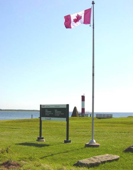
Photographed on 8 August 2005
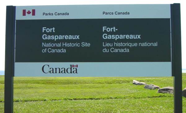
Photographed on 8 August 2005
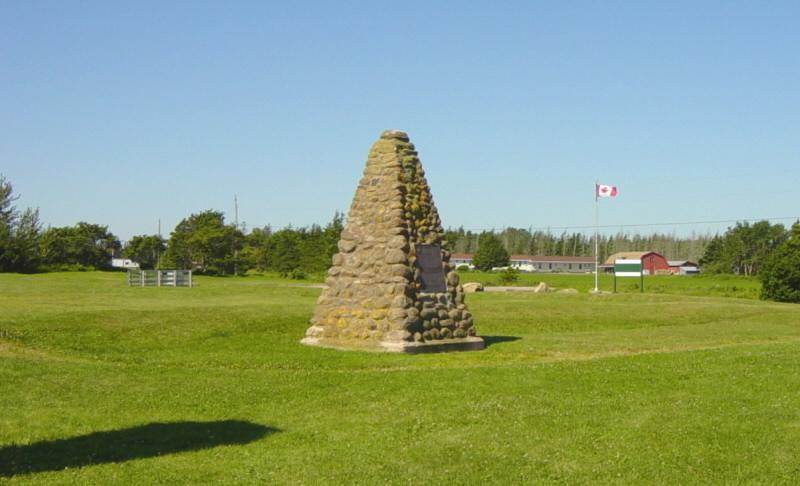
Photographed on 20 July 2006
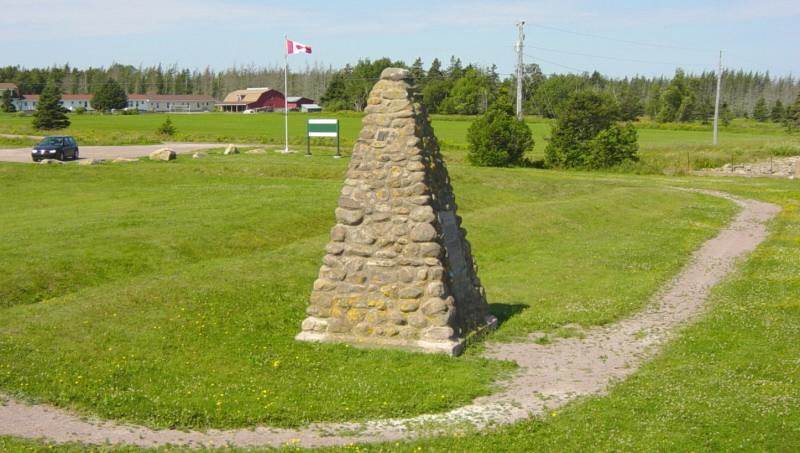
Photographed on 8 August 2005
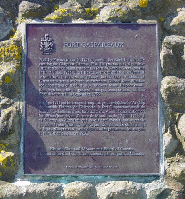
Photographed on 20 July 2006
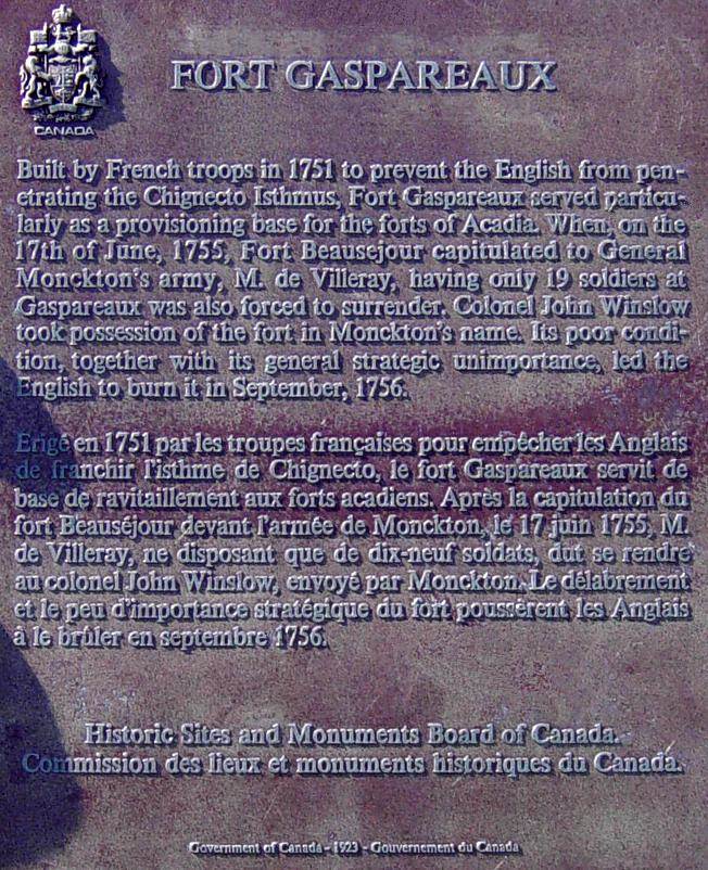
Photographed on 20 July 2006

Plaque date 1923
Photographed on 20 July 2006
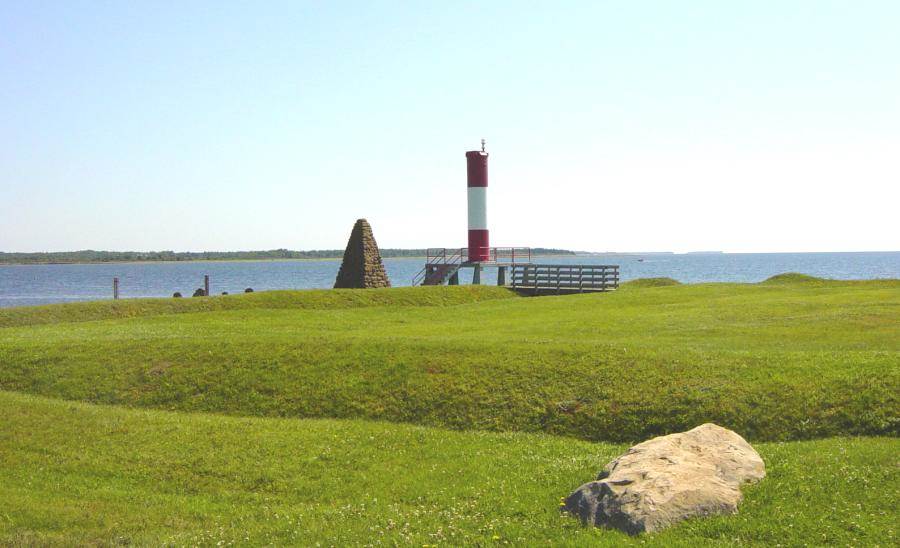
Photographed on 8 August 2005
Frequently-used alternative spellings:
Fort Gaspareau Fort Gaspereaux Fort Gaspereau
Timeline: Significant Historical Events of 1755 by Peter Landry
1755 April 14: The Colonial governors gather at The Council at Alexandria.
1755 June 16: Fort Beausejour surrenders.
1755 June 18: Fort Gaspereau surrenders without a shot being fired.
1755 July 9: General Braddock sustains a terrible defeat near Fort Duquesne.
http://www.blupete.com/Hist/Dates/1755.htm
Timeline: Seven Years War 1755, by The Seven Years War Association Journal
April 14, 1755: English Brigadier General Edward Braddock arrives in Virginia
with two regiments of English regulars and begins plans to march on Fort Duquesne.
June 4-15, 1755: Siege and capture of Fort Beausejour, North America,
held by 460 French commanded by Duchambon de Vergor, at Chignecto peninsula
(now New Brunswick), it is invested by Colonel Robert Monckton commanding
2000 Massachusetts volunteers, and falls after a brief bombardment.
Nearby Fort Gaspereau is immediately abandoned by its French garrison.
1751 Sketches of Fort Gaspereau Peter Landry
http://www.blupete.com/Hist/NovaScotiaBk1/Part6/Scenes/FortGasper.htm
1751 Sketches of Fort Gaspereau L’Association Internationale des Familles Rivard
http://rivards.iquebec.com/fortifications_lieux/fortifications_lieux_canada/
5_province_newbrunswick/fort_gaspereau/acceuil_fort_gaspereau.htm
Fort Gaspareau by Quebec History Encyclopedia
http://www2.marianopolis.edu/quebechistory/encyclopedia/FortGaspareau.htm
Acadian Settlement by Mount Allison University, Sackville, New Brunswick
…The French hold on the region was a tenuous one following the Treaty
of Utrecht in 1713 which granted much of Nova Scotia to the British.
The Isthmus of Chignecto, with its position at the head of the Bay of Fundy,
formed one of a series of uneasy frontiers in the contest between the French
and the English for control of the region. For the Acadians living on or near
the marshes, these events formed an unwanted intrusion on the demands of
everyday life. Their preoccupation was with the maintenance and extension
of their marsh agriculture and with trade that was as much dependent upon
markets in Boston as it was with supplying the French colonial bastion at
Louisbourg. In Chignecto these geopolitical events led the French authorities
to build two defensive positions: Fort Gaspereaux on the Northumberland side
of the Chignecto isthmus, and the larger Fort Beausejour on the Fundy side,
which were operational by 1755. At about the same time the British authorities
constructed Fort Lawrence on an adjacent ridge so that these two defensive
positions faced each other in the middle of the marsh. The climax of this
struggle came with the defeat of French forces by the British, both at Chignecto
and in the larger geopolitical struggle for North America in 1755…
http://www.mta.ca/marshland/topic4_acadians/acadian.htm
Louis-Francois La Corne by Peter Landry
…With the arrival of Governor Jonquiere, in 1749, Chevalier Louis-Francois
La Corne was sent to Chignecto at the head of a French military force with
orders to hold Chignecto and to convince the Acadian inhabitants thereabouts
(Beaubasin) to move west of the Missaguash River conceding peninsular
Nova Scotia to the English. Arriving in November of 1749, La Corne set about
his work. Immediately he commenced the construction of Fort Beausejour.
At the other end of the isthmus, at Baie Verte, about twenty kilomtres to the
northeast, Fort Gaspereaux was started. During April 1750, the English made
their counter move – readily able to so, as Cornwallis, by then, had established
a strong English presence at Chebucto (Halifax). Cornwallis sent one of his
chief officers, Major Charles Lawrence with 400 men. The English took issue:
La Corne was not to be in Acadia; and, being so, was in breach of their recent
treaty, a term of which was that Acadia was confirmed to be English territory.
The French did not dispute that fact; but, rather, held a different opinion as to
the extent of Acadia. The French were of the view that Acadian territory ended
at the Missaguash River; and, to the west of it, was Canadian (New France)
territory. Lawrence was to establish himself in a newly built fort, Fort Lawrence.
Thus it was, by the end of summer, 1750, we would have seen the French
(at Fort Beausejour) and the English (at Fort Lawrence) staring at one another
across the Missaguash. In the midst of this stalemate, in October of 1750,
La Corne was replaced and recalled to Quebec…
http://www.blupete.com/Hist/BiosNS/1700-63/Corne.htm
The Roads that Hug the Strait
…Baie Verte and Port Elgin were intimately linked to the Tantramar French Acadian
settlements by the old French road connecting Fort Beausejour, Baie Verte, and
Fort Gaspereau at Port Elgin where French supply ships docked en route from
Louisbourg to Quebec. Fort Street in Port Elgin takes you there…
http://www.gomoncton.com/ENSite/Visit/DT_Strait.html
Seven Years War
Timeline of the Seven Years War 1754-1763
The period 2004-2013 is the 250th anniversary of the
Seven Years War, a.k.a. the French and Indian War.
Includes important events in Nova Scotia.
https://ns1763.ca/remem/7yw-timeline-w.html

