Frosty Hollow Communications Route
Before 1784, this area — now known as Westmorland County,
New Brunswick — was part of Sunbury County in Nova Scotia.
Historic events that occurred here in the 1750s, 1760s, and 1770s
took place in what was then Nova Scotia. Plaques and monuments
commemorating events that happened here before 1784 are included
in this collection of Nova Scotia historic markers. These include the
construction of Fort Beausejour and Fort Gaspareaux in 1751 by the
government of France led by King Louis XV, and the capture of
these two forts in 1755 by British forces – early actions in the
great conflict, now known as the Seven Years War, that
decided the fate of all North America north of Mexico.
From 1759 to 1784, Nova Scotia and Massachusetts shared a common boundary.
Nova Scotia’s western boundary was the eastern boundary of Massachusetts.
In 1784, the Nova Scotia side of this boundary became New Brunswick.
In 1820, the Massachusetts side of this boundary became Maine.
The ancient portage route memorialized at Frosty Hollow
in 1952 was of strategic and economic importance to both
the Mi’kmaq and those who immediately followed them.
—
Bill Hamilton Sackville Tribune-Post, 24 May 2002
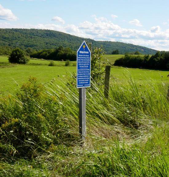
Frosty Hollow
Westmorland County, New Brunswick
(formerly Sunbury County, Nova Scotia)
Officially unveiled on 16 May 1952
Located on the south side of Highway 106, about 5.5km west from downtown Sackville
GPS location: 45°52’26″N 64°25’01″W

Photographed on 30 May 2006

Photographed on 30 May 2006
Photographed on 30 May 2006
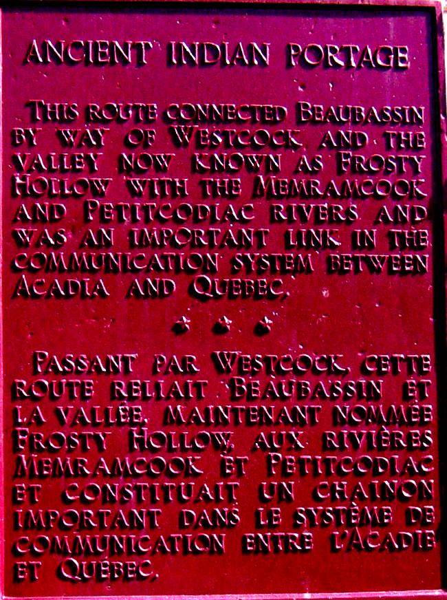
Ancient Indian Portage
This route connected Beaubassin by way of Westcock, and the
valley now known as Frosty Hollow with the Memramcook
and Petitcodiac Rivers and was an important link in the
communication system between Acadia and Quebec.
This communication system was used for
both military and administrative purposes.

Photographed on 30 May 2006
On 16 May 1952, the Historic Sites and Monuments Board of Canada
unveiled a cairn to commemorate the site of an early Mi’kmaq/Acadian
portage at Frosty Hollow, near Sackville, New Brunswick.
This portage helped link the Acadian settlement of Beaubassin
with the Memramcook Valley and was an essential part of the
communications network between Acadia and New France.
After the British conquest the portage continued in use until
the first road connecting the Memramcook Valley with the
Tantramar Region was built. The event also focussed attention
on the convergence of several other canoe/portage routes through
the Mi’kmaq district of Siknikt – now the Isthmus of Chignecto…
Source:
Paddling Through History: The Portage Routes Of Siknikt/Chignecto
by Bill Hamilton, Sackville Tribune-Post, 24 May 2002
http://www.billhamiltonflashback.ca/listnews.php?
id=99&cid=1&searchtext=&offset=20
Ancient Indian Portage Tantramar Historic Sites
This route from the Gulf of St. Lawrence to the Bay of Fundy was
the chief means of communication between Quebec, Isle Royale, and
Chignecto. The portage connected the Baie Verte and Missaguash rivers.
http://heritage.tantramar.com/HS17_1.html
Marked Historic Sites in Sackville and Area – 17th Century and Earlier
http://heritage.tantramar.com/HS17C.html
Acadian Settlement by Mount Allison University, Sackville, New Brunswick
…The French hold on the region was a tenuous one following the Treaty
of Utrecht in 1713 which granted much of Nova Scotia to the British.
The Isthmus of Chignecto, with its position at the head of the Bay of Fundy,
formed one of a series of uneasy frontiers in the contest between the French
and the English for control of the region. For the Acadians living on or near
the marshes, these events formed an unwanted intrusion on the demands of
everyday life. Their preoccupation was with the maintenance and extension
of their marsh agriculture and with trade that was as much dependent upon
markets in Boston as it was with supplying the French colonial bastion at
Louisbourg. In Chignecto these geopolitical events led the French authorities
to build two defensive positions: Fort Gaspereaux on the Northumberland side
of the Chignecto isthmus, and the larger Fort Beausejour on the Fundy side,
which were operational by 1755. At about the same time the British authorities
constructed Fort Lawrence on an adjacent ridge so that these two defensive
positions faced each other in the middle of the marsh. The climax of this
struggle came with the defeat of French forces by the British, both at Chignecto
and in the larger geopolitical struggle for North America in 1755…
http://www.mta.ca/marshland/topic4_acadians/acadian.htm
Seven Years War
Timeline of the Seven Years War 1754-1763
The period 2004-2013 is the 250th anniversary of the
Seven Years War, a.k.a. the French and Indian War.
Includes important events in Nova Scotia.
https://ns1763.ca/remem/7yw-timeline-w.html